
Bunnanimma [Grieve Hill]
Good walks are even better shared.
Overview
Exploring Bunnanimma (Grieve Hill)
Bunnanimma, or Grieve Hill as it's often called, stands proudly at an elevation of 499 meters, offering both challenge and reward for the intrepid hiker. Nestled in the Southern Uplands, this Marilyn attracts outdoor enthusiasts looking for a slice of tranquillity and panoramic views.
Geology
This area showcases a stunning geological tale spanning millions of years, primarily featuring volcanic rock and sedimentary layers. Those with a keen eye might spot various strata and rock formations that whisper secrets of the earth's past. Make sure to bring a geology book unless you're keen on starting your own rock collection!
Routes
The popular Mull of Galloway Trail is the starting point for most hikers aiming for the summit. Stretching over 6.5 kilometers, this moderate trail winds its way through lush greenery and offers impressive views as you ascend. Estimated time for the hike is around 2.5 hours, perfect for a leisurely afternoon.
Summit Features
Upon reaching the summit, you'll be greeted by a charming stone cairn—a classic hallmark of the Scottish hills. It's a lovely spot to pause, catch your breath, and soak in the beauty that surrounds you.
Terrain Type
Bunnanimma's terrain is predominantly grassy, interspersed with the occasional rocky outcrop, ideal for a satisfying hike. The balance makes it approachable for hikers of various skills—just watch your step in the wetter sections!
Views
From the summit, the vistas are nothing short of spectacular. You'll be treated to sweeping views of the Cree Estuary and the rolling hills of Galloway Forest Park, which transform with the seasons—spring's flowers or autumn's fiery hues. Don't forget your camera; this is a perfect spot for that picturesque ‘Instagrammable’ snap.
Best Seasons
The best times to visit are spring and early autumn, when the skies are more likely to be clear, allowing you to drink in those panoramic views without a cloud in sight.
Hazards
One thing to remember: the weather here can change quicker than a sheep can jump a fence! Be prepared for unexpected rain, and always check the forecast before heading out.
Nearby Summits
If you're feeling particularly adventurous, why not tackle the nearby Beneraird (502m) or Green Hill of Troweir (458m)? Each offers its own unique charm and scenic delights.
Access and Facilities
Access to Bunnanimma is relatively straightforward, with a small parking area at the Mull of Galloway Trailhead. For those reliant on public transport, services are available from Stranraer, but check the timetable to avoid the dreaded wait!
While there are no facilities right on the hill, Stranraer is just a short drive away, providing ample refuelling opportunities after your trek.
History
The name Bunnanimma evokes images of sheep dotting the landscape, reflecting the agricultural significance of the area. Historically, it has been a landmark for locals, providing not only breathtaking views but also a connection to the pastoral traditions that define the region.
So, gather your hiking boots and head on out to Bunnanimma for a day filled with learning, exploration, and perhaps even a laugh or two along the way!
Explore routes near Bunnanimma [Grieve Hill]
Public walks starting within 80 km of this hill. Nearby does not mean a route reaches the summit; check its map and access before setting out.
Scarva to Poyntzpass: Newry Canal and Lough Shark Return
View route
Portadown to Knock Bridge: Bann Boulevard and Moneypenny’s Lock
View route
Peatlands Park Red Trail: Annagarriff Wood and Derryadd Lough
View route
Florence Court: Riverside and Forest Circuit, County Fermanagh
View route
Route planning notes
These notes describe possible approaches, not verified navigable routes or permission to cross land. Check current paths, local access rules and conditions before setting out.
Mull of Galloway Trail
A picturesque trail starting from the Mull of Galloway, leading you through lush green valleys and up to the summit of Grieve Hill.
Make a day of it, together
Find someone to share the walk with, or organise a day out along a route you like.
Hill facts and local notes
Classifications
Elevation
268m
879 ft
Prominence
136m
Coordinates
54.0756, -6.9039
H718146
OS Map
28
At the Summit
The summit features a small stone cairn and offers a great vantage point with panoramic views of the surrounding countryside.
Terrain & Geology
Bunnanimma, like many hills in the Southern Uplands, is primarily composed of volcanic rock and sedimentary deposits, providing a fascinating insight into the geological history of the area.
Views & Scenery
From the summit, hikers can enjoy views of the Cree Estuary, the rolling hills of the Galloway Forest Park, and, on a clear day, even the mighty peaks of the Isle of Arran.
History & Heritage
Name Origin
The name Bunnanimma is thought to derive from a local dialect meaning 'hill of the sheep', highlighting its agricultural heritage.
Historical Significance
The hill has long been a beacon for both local farmers and hikers, symbolising the natural beauty of the region.
Getting There & Facilities
Check current local access restrictions, parking rules and transport timetables before travelling. These notes do not confirm public access to the summit.
Parking
There is a small parking area near the start of the Mull of Galloway Trail, with enough space for about 5-6 cars.
Public Transport
The nearest bus service operates from Stranraer to the Mull of Galloway, but check local timetables as frequencies can vary.
Nearby Facilities
While you won't find any cafes directly on the mountain, Stranraer has plenty of options for refreshments and toilets.
Safety Information
Known Hazards
- Be cautious of sudden weather changes typical of the area; always be prepared for rain, even in the sunshine!
General Safety Tips
- Check weather conditions before setting out
- Carry appropriate clothing and equipment
- Let someone know your planned route
- Take a map, compass, and GPS device
- Carry emergency supplies: food, water, first aid kit, torch
Hills
Some common questions about the hills answered
Are there group walks up Bunnanimma [Grieve Hill]?
Many walkers use Walkmates to join or organise walks with others. You can check for group walks around Bunnanimma [Grieve Hill] through the maps
Are there other walkers around Bunnanimma [Grieve Hill]?
Activity varies by location and time, but Walkmates lets you see whether others have shared walks or shown interest in this area. Find other people through the walking friends search walking friends for Bunnanimma [Grieve Hill] search or of course create your own walk for Bunnanimma [Grieve Hill]
Can I organise a walk to Bunnanimma [Grieve Hill]?
Yes. If there aren’t any walks listed already, you can create a walk and make it available for others to join.
If you're signed up to Walkmates, you can create a walk to Bunnanimma [Grieve Hill].
How do I find a walk up this hill?
There are often multiple ways to walk this hill, depending on experience and route preference. Walkmates helps you explore walks and routes that others have shared.
Can I suggest a new route up Bunnanimma [Grieve Hill]?
Yes. You can suggest or create routes to share with others. Walkmates focuses on the social side of walking, so routes are used to help people organise walks and explore areas together, rather than as detailed navigation tools or route libraries.
Other uses really appreciate knowledgeable walkers sharing their routes. Share your favourite route to Bunnanimma [Grieve Hill] here
The is an error or something incorrect about this hill. How do I let you know?
We always strive to keep the information on Walkmates as accurate as possible. If you find an error, please let us know through the contact form and we'll aim to correct it as quickly as possible
Community Discussion
Comments
Location
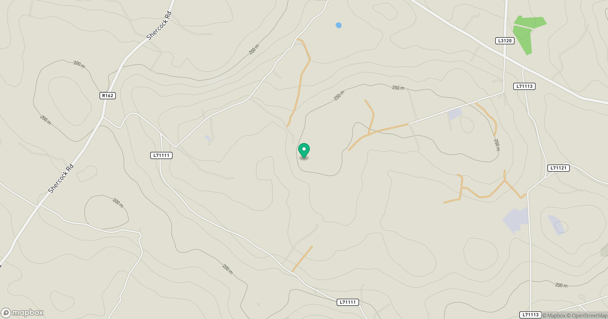
Grid reference: H718146
View on OpenStreetMapOpens a map in a new tab, centred on the hill.
Hills within 30 km
Straight-line distance, not a walking route or confirmation of access.
Tievenanass
261m
Mullyash Mountain
317m
Carrickleck Hill [Carraig Leice]
173m
Carrigatuke
365m
Shantemon
218m
No comments yet. Be the first.